Skip to content
Menu
Wandering Wim's Blog
  • Home
  • About
  • Donate
  • Contact
Wandering Wim's Blog

Hagenbachklamm & Donau Altarm

Posted on March 22, 2023March 22, 2023

Description

From Unterkirchbach down the Hagenbachklamm, through St. Andrä with its pretty church, and on to the Donau Altarm, ending up in Greifenstein. An easy but very pleasant hike.

Map & data

The hike and elevation profile. Click the image for a larger version.

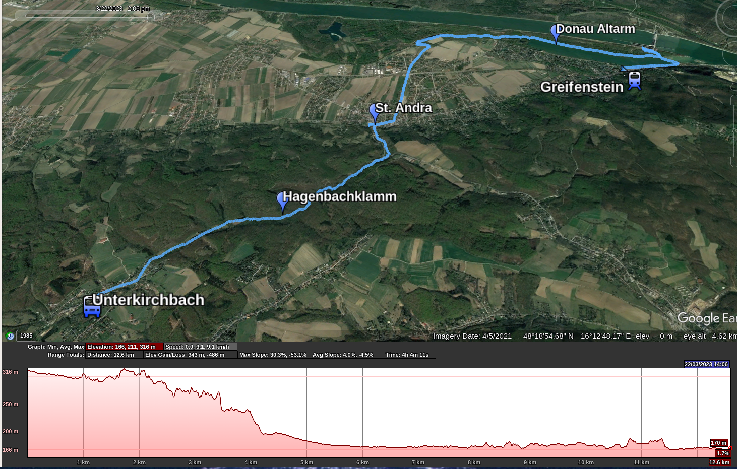
GPS track: Hagenbachklamm.gpx — Total length: 13km — Cumulative elevation: +50/-200m

Public transport: Bus 445 from Wien Hernals to Unterkirchbach. Train (S40) from Greifenstein to Wien Heiligenstadt.
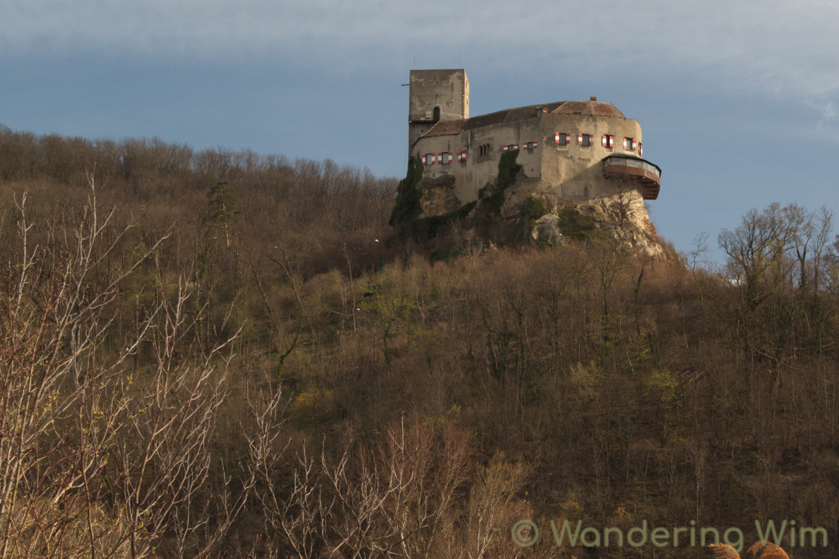
Images

Share this:

  • Click to share on Twitter (Opens in new window)
  • Click to share on Facebook (Opens in new window)
  • Click to share on LinkedIn (Opens in new window)

Traveling broadens the mind.
Hiking strengthens the body.
Photography elevates the soul.


Get notified about new posts:

If you appreciate the contents of this blog, please help keep it alive!

Prints of some of my photographs and other art are available at

©2023 Wandering Wim's Blog | WordPress Theme by Superb WordPress Themes