Skip to content
Menu
Wandering Wim's Blog
  • Home
  • About
  • Contact
Wandering Wim's Blog

Klauser Stausee

Posted on July 20, 2022July 20, 2022

Description

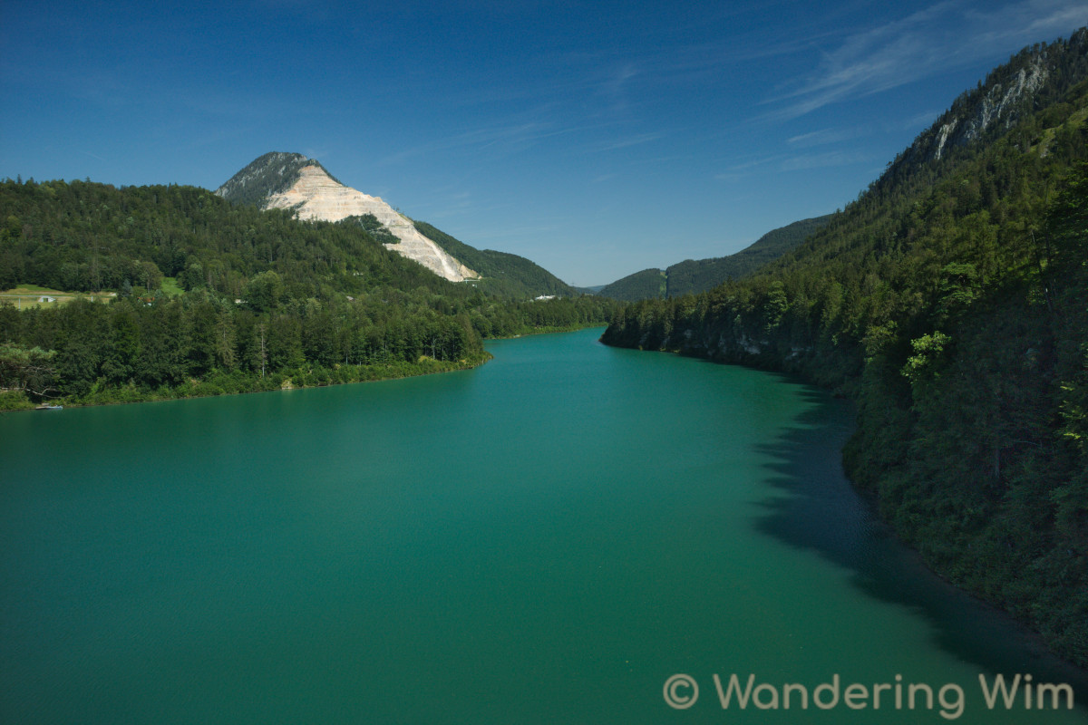
A hike along the Klauser Stausee (a reservoir), from the Hinterstoder Bahnhof to the Klaus an der Pyhrnbahn Bahnhof. The color of the water is just amazing…

Map & data

The hike and elevatio profile. Click the image for a larger version.

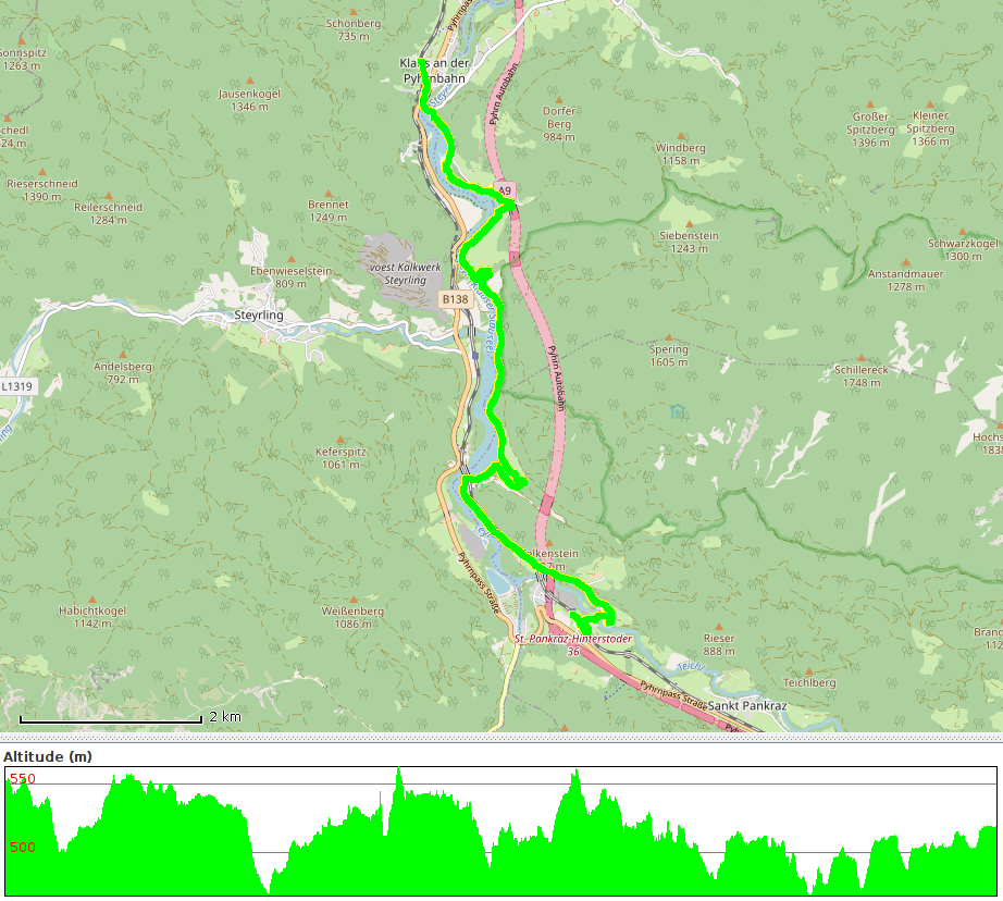
GPS track: KlauserStausee.gpx — Total length: 12km — Cumulative elevation: +/-350m

Public transport: Train to Hinterstoder Bahnhof and return from Klaus an der Pyhrnbahn Bahnhof.

Images

Share this:

  • Click to share on Twitter (Opens in new window)
  • Click to share on Facebook (Opens in new window)
  • Click to share on LinkedIn (Opens in new window)

Traveling broadens the mind.
Hiking strengthens the body.
Photography elevates the soul.


Get notified about new posts:

If you appreciate the contents of this blog, please help keep it alive!

©2023 Wandering Wim's Blog | WordPress Theme by Superb WordPress Themes