Skip to content
Menu
Wandering Wim's Whims
  • Home
  • About
  • Donate
Wandering Wim's Whims

Prielschutzhaus

Posted on July 18, 2022July 11, 2023

Description

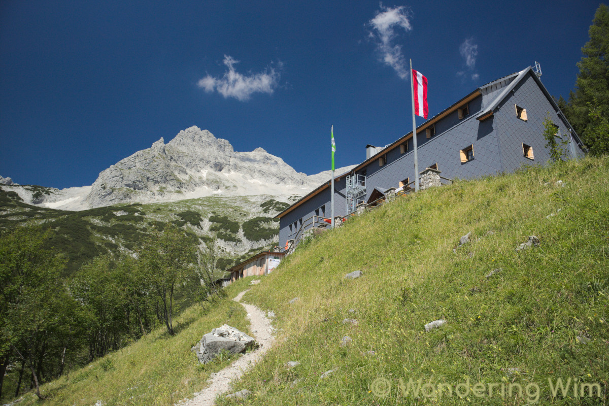
A strenuous hike up to the Prielschutzhaus (an Alpine hut) on a steep and rocky trail. But with stunning views along the way! Back down the same way.

Map & data

The hike and elevation profile. Click the image for a larger version.
A 3D view of the hike. Click the image for a larger version.

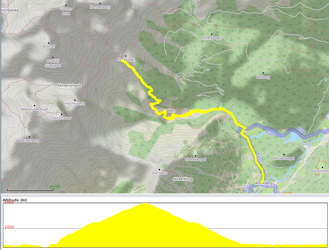
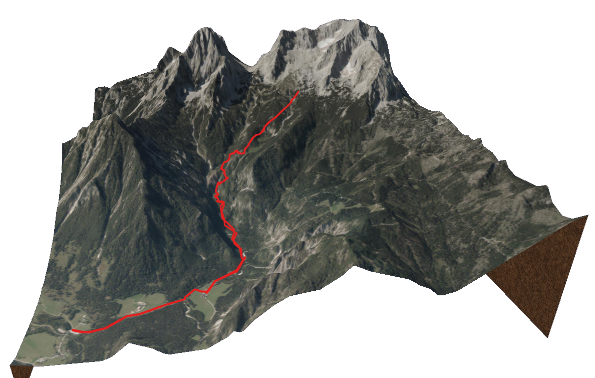
GPS track: Prielschutzhaus.gpx — Total length: 11.5km — Cumulative elevation: +/-800m

Public transport: Bus 431 from Hinterstoder Bahnhof to Hinterstoder Gemeindehaus, then bus 432 to Polsterlucke parkplatz or Polsterstüberl.

Images

Share this:

  • Click to share on X (Opens in new window) X
  • Click to share on Facebook (Opens in new window) Facebook
  • Click to share on LinkedIn (Opens in new window) LinkedIn

Traveling broadens the mind.
Hiking strengthens the body.
Photography elevates the soul.


Get notified about new whims:

Please help keep this blog alive!


Disclaimer: Content provided for education and entertainment only. The blog author is not responsible for any consequences resulting from its content's use. Always use your own discernment.

©2025 Wandering Wim's Whims | WordPress Theme by Superb WordPress Themes