Skip to content
Menu
Wandering Wim's Blog
  • Home
  • About
  • Contact
Wandering Wim's Blog

Stodertal Höhe-Runde

Posted on July 17, 2022July 17, 2022

Description

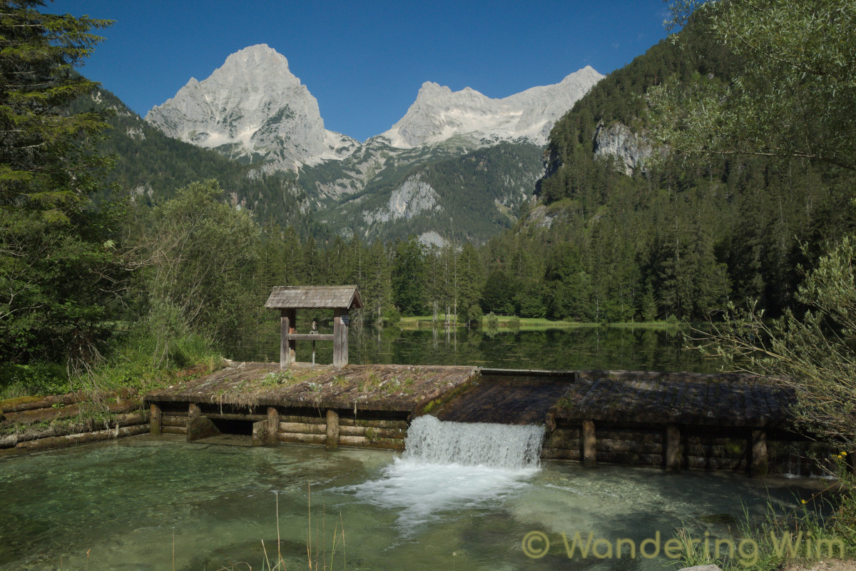
A relatively easy but extremely scenic hike around the Stoder valley along the Stodertal Höhe-Runde. This hike starts in the little mountain village of Hinterstoder, and passes by the Schiederweiher, voted the most beautiful spot in Austria in 2018. No surprise!

Map & data

The hike. Click the image for a larger version.
Elevation profile. Click the image for a larger version.

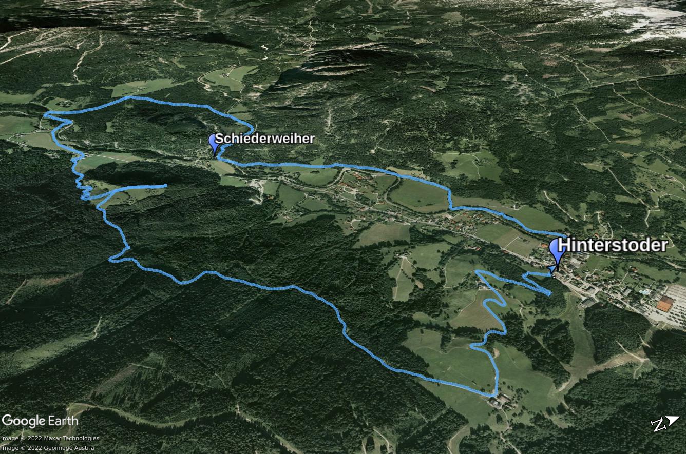
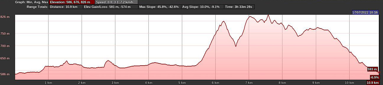
GPS track: Stodertal.gpx — Total length: 11km — Cumulative elevation: +/-300m

Public transport: Train to Hinterstoder Bahnhof, bus 431 to Hinterstoder Gemeindehaus.

Images

Share this:

  • Click to share on Twitter (Opens in new window)
  • Click to share on Facebook (Opens in new window)
  • Click to share on LinkedIn (Opens in new window)

Traveling broadens the mind.
Hiking strengthens the body.
Photography elevates the soul.


Get notified about new posts:

If you appreciate the contents of this blog, please help keep it alive!

Prints of some of my photographs and other art are available at

©2023 Wandering Wim's Blog | WordPress Theme by Superb WordPress Themes