Description
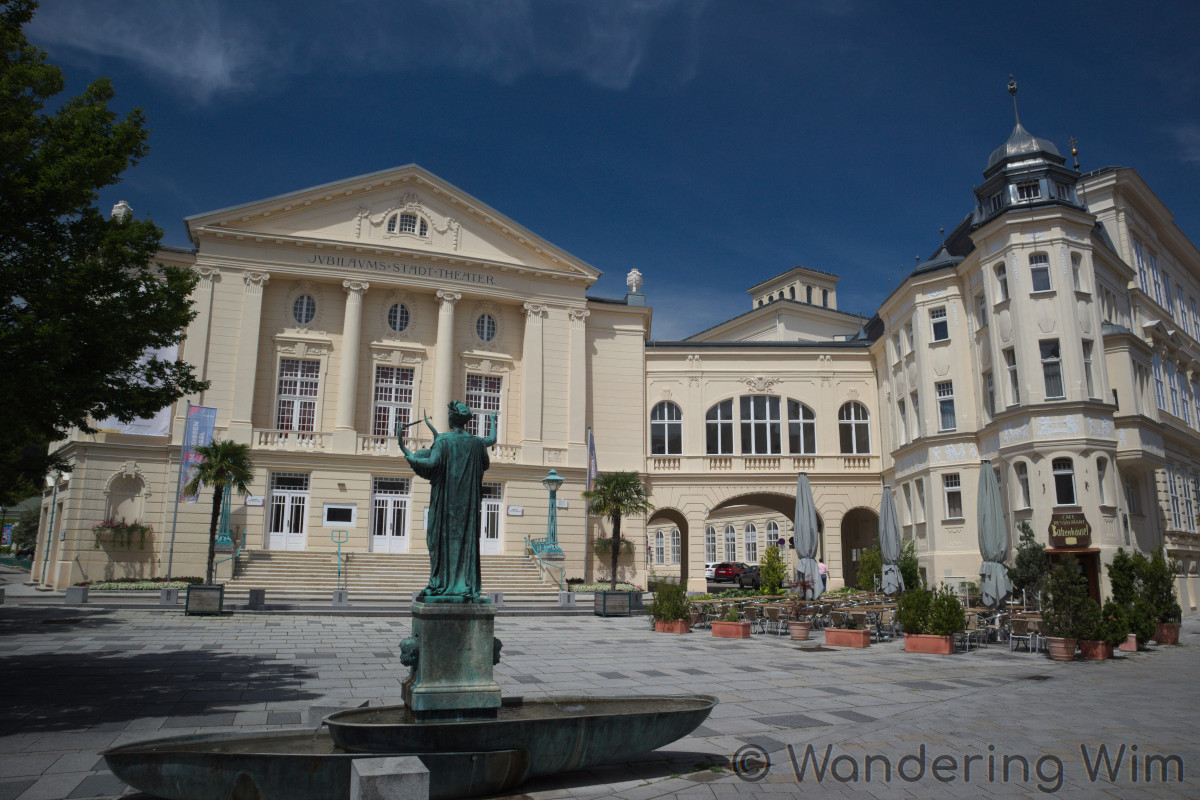
Two days in Baden bei Wien, to explore the town and do some hiking in the surrounding hills.
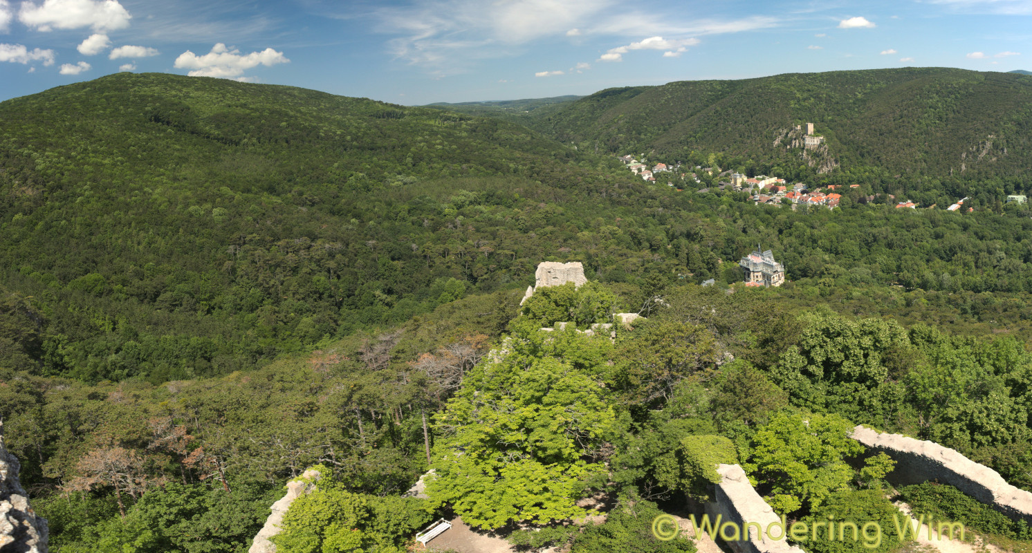
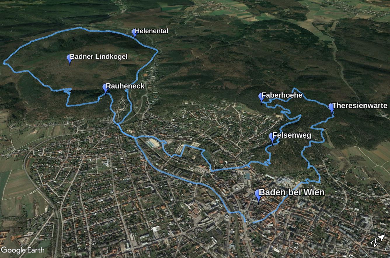
The first day I went up to the Theresienwarte, a lookout tower with good views, then over to the viewpoint at the Faberhöhe, and back to Baden via the Felsenweg. Later in the afternoon and evening I walked around the town center for a while. The next morning I followed the Beethoven Wanderweg through the Helenental, then around the Badner Lindkogel to Rauheneck, the ruins of a medieval castle, and finally back to Baden.
Map & data
GPS tracks:
BadenFelsenweg.gpx — Total length: 6.5km — Cumulative elevation: +/-200m
BeethovenWanderweg.gpx — Total length: 12.5km — Cumulative elevation: +/-250m
Public transport: Train or Wiener Lokalbahn to Baden.
Images
Panorama
Click on the image below to view the panorama (last image in the slideshow) in full size.